Blog #002: Exploring SAGADA: Take a breather with Nature
Sagada was founded as a refuge from lowland headhunters; later, it acted as a safe haven for those fleeing first the Spanish and then 20th-century dictators. The town's far-flung location and steep terrain kept it isolated, and today you can still glimpse the traditional Igorot way of life.
Sagada, officially the Municipality of Sagada, is a 5th-class municipality in the province of Mountain Province, Philippines. According to the 2020 census, it has a population of 11,510 people.
ECHO VALLEY
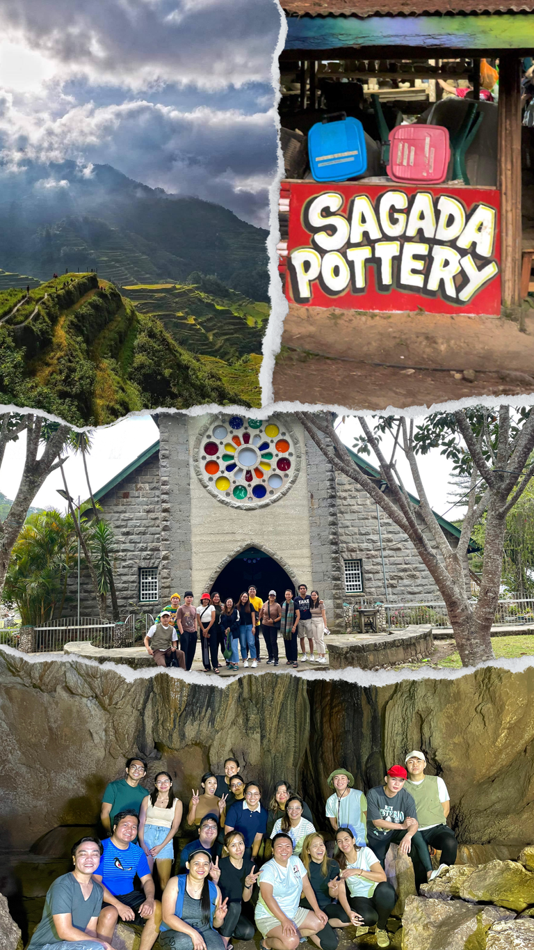
Sagada is a town in the Cordillera Mountains, within the Philippines’ Mountain Province. Echo Valley hanging coffins are displayed high on cliffs, while centuries-old coffins are stacked in burial sites like Lumiang Cave. The nearby Sumaguing Cave has unusual limestone formations. To the north, Bomod-ok Falls has a natural swimming pool. Rice terraces are carved into the area surrounding mountainsides
HANGING COFFINS
Hanging coffins is a unique burial ritual. The elderly carve their own coffins out of hollowed logs. If they are too weak or ill, their families prepare their coffins instead. The dead are placed inside their coffins (sometimes breaking their bones in the process of fitting them in), and the coffins are brought to a cave for burial.
Instead of being placed into the ground, the coffins are hung either inside the caves or on the face of the cliffs, near the hanging coffins of their ancestors. The Sagada people have been practicing such burials for over 2,000 years, and some of the coffins are well over a century old. Eventually, the coffins deteriorate and fall from their precarious positions.
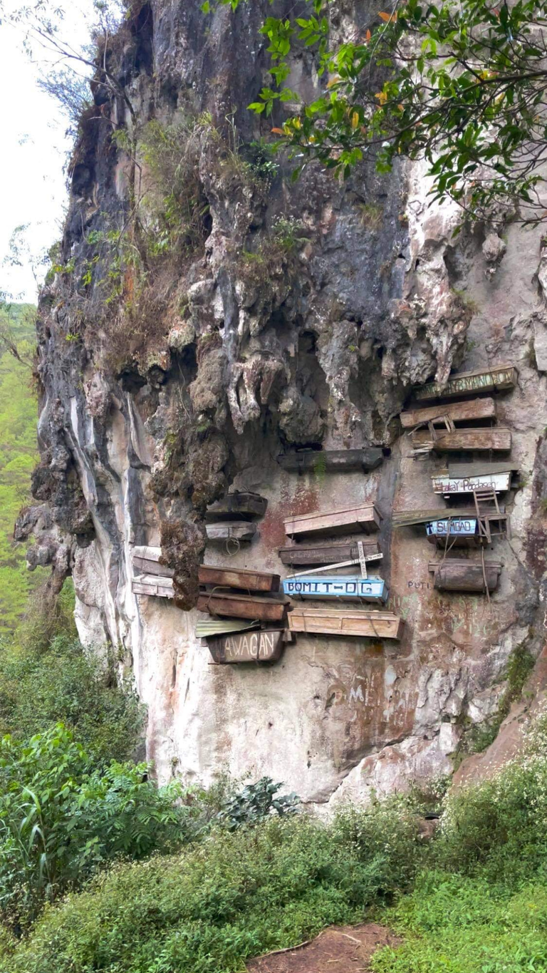
The reason the coffins were hung was due to the belief that the higher the dead were placed, the greater the chance of their spirits reaching a higher nature in the afterlife. Many of the locations of the coffins are difficult to reach (and obviously should be left alone out of respect), but they can be appreciated from afar.
SUMAGUING CAVE
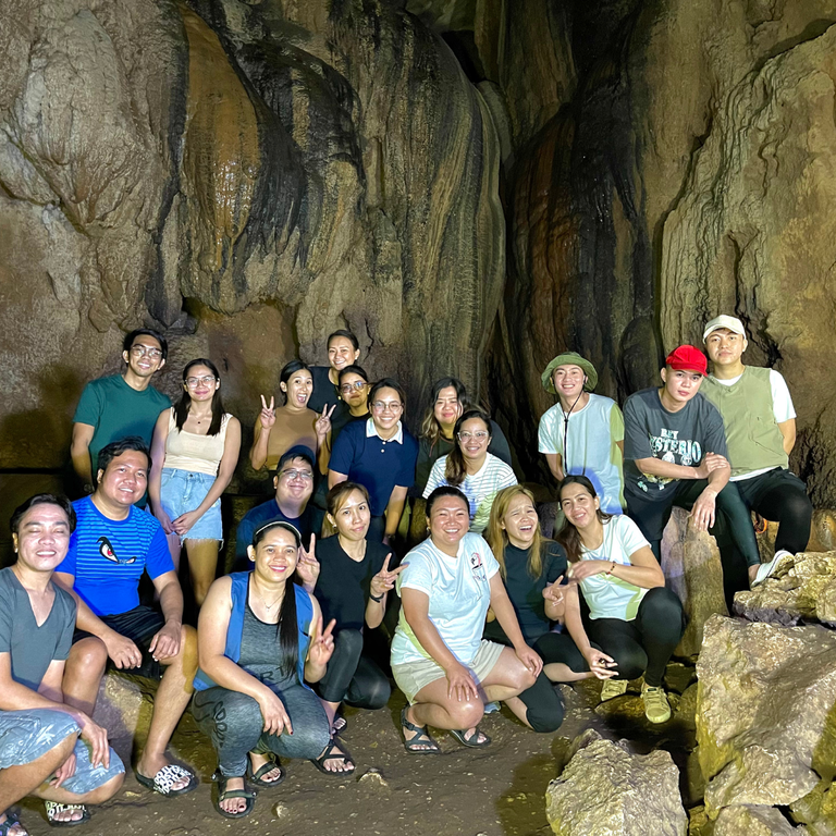
The Sumaguing Cave is the biggest one in Sagada. The rock formations that resemble common forms are the highlight of this incredible adventure. The bird and elephants, the tortoise, and chocolate cake are some of these formations.
ROCK FORMATION

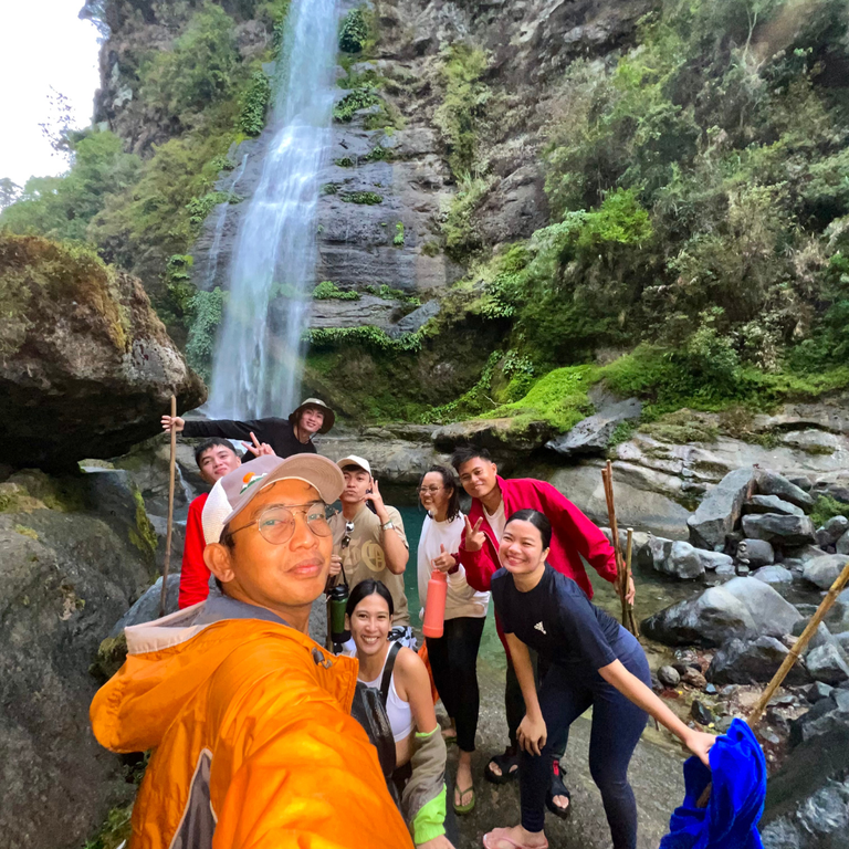
BOMOD-OK FALLS
Bomod-Ok Falls, or The Big Falls, is situated in the northern part of Sagada, near the small towns of Fidelisan and Pide. It is a 4.2-kilometer walk from the jump-off point. We rode on top of a jeep from the town proper to the registration area of the Bomod-Ok Falls Tour in Brgy. Bangaan.
After registration and an overview, our group started the hike. The start of the trail has narrow, uneven steps going down through the small town of Fidelisan. Most of the trail was fenced by thick vegetation with an abundance of sunflowers. Hidden between mountains, a 200-ft waterfall showed itself. Massive amount of water gushing from a mountain cliff to a rocky basin. The impact was so strong that we felt the cold wind with mist from afar.

We looked for a safe spot where we could leave our bags before going near the basin. We stayed on the left side since the there’s a passageway under the foot of the cliff that sheltered us from the gust of wind and water. The freezing cold water helped relaxed our sore muscles from all of the activities we did. Going back was a different challenge. From the falls, we re-traced our route to the town of Fidelisan. From there, we took a different path and passed thru the rice terraces of Pide.
This was the last activity on our Sagada experience.
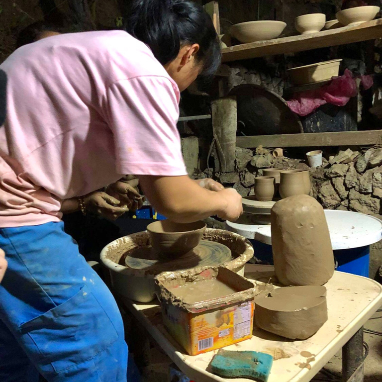
SAGADA POTTERY
Sagada Pottery Center was initiated by Archie Stapleton, an American potter and a son of missionaries from Philippine Episcopal Church assigned in Sagada back in the 1960’s. Archie was only 12 years old when the family left for the U.S.
where he trained to become a potter. In 2000, he returned to Sagada and grew to love the place over the years. It was here that he trained and organized a small group of local artisans interested in learning pottery as a craft.
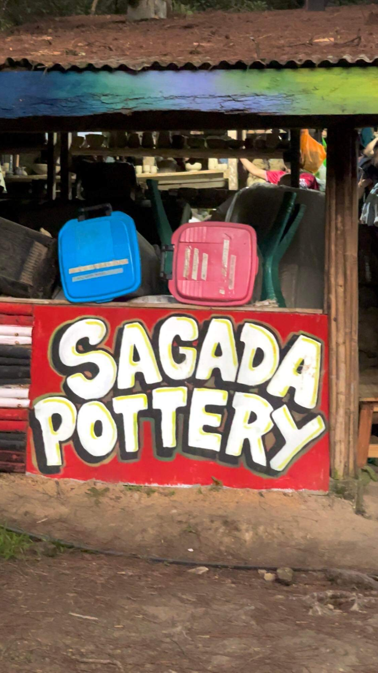
The clay used for these potteries are all sourced locally. When a clay source is located, they first get samples for testing at the center where it’s exposed to 2,500 F in a kiln to see if the material can stand the heat and not crack or break. If it passes the heat test, they haul more clay to the center where it’s soaked for at least a month to loosen it up. After the soaking process, the clay is sieved to achieve a high level of fineness and consistency. The clay will become watery so it is dripped-dry first, and after 20% minerals (like kaoline and silica) are mixed to 80% natural clay it is then aged for at least three weeks or until it is ready for moulding into the different shapes on the wheel.
POTTERY MACHINE
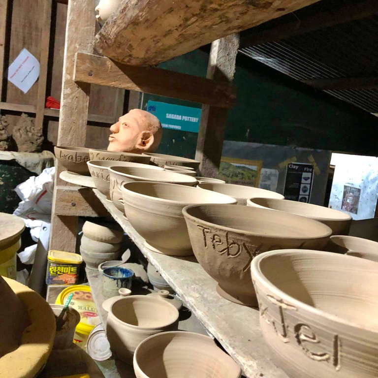
After shaping the pottery, it is then half-baked and bisque-fired in a kiln through a process called ‘bisquiting’, producing an orange or ‘unglazed pottery’. This initial firing ensures that all the moisture is removed from the pottery. The next step is called glazing, where a coating of vitreous substance is applied and then undergoes a second firing called ‘glaze firing’ to melt the glaze, sealing the stoneware and giving it a glassy finish.
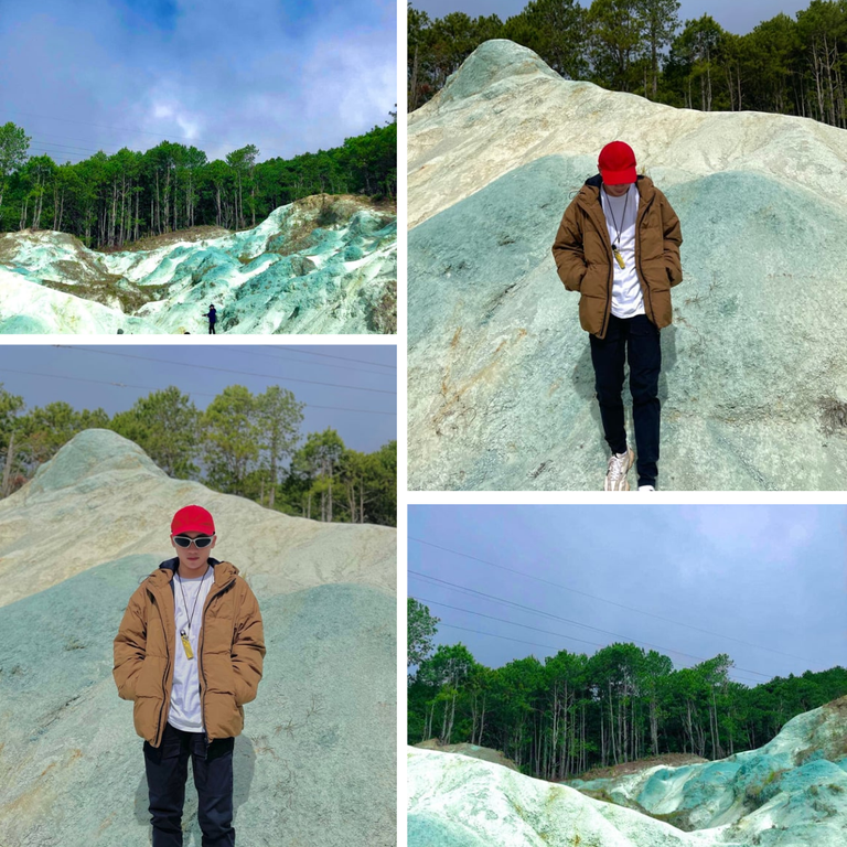
BLUE SOIL HILLS
During our descent, the weather turned from a foggy morning to a clear day.
We walked downhill and uphill on muddy paths and rugged terrain. The trail was surrounded by pine trees. There were parts with dense pine trees, which provided shade for this exhausting trek.
It took us over 2 hours to reach the Blue Soil Hills. The Blue Soil Hills are a patch of limestone rocks with a tint of blue. The hill is bounded by thick pine trees, which has a hidden effect on this place.There were several food stalls at the entrance. Our group immediately bought snacks and took a short break before we started taking photos.We traversed for another hour to the main road to complete the whole tour.
MARLBORO HILLS
We started the adventure around 4AM to reach Marlboro Hills before sunrise.Marlboro Hills is Sagada’s highest peak and has a breathtaking 360 unobstructed view of the mountain ranges. It is also a great view point for the sunrise and sea of clouds.From the jump-off point, it took us around 3 hours of trekking to reach the peak. I thought it would be easy because of the cool climate. But it was harder to breathe in high altitude especially if you are constantly gasping cold air. When we reached the peak of Marlboro Hills, there were several food stalls near the entrance and the place was too crowded for a regular weekend. Unfortunately, the sun was shy that day and there was a thick fog obscuring the view. Slightly giving you a glimpse of the rice terraces.

See you on my next blog!...Peace!
Location: Sagada Mountain Province
ctto:templates from canva
I was most fascinated by the view of the waterfall which was very spectacular, it was a very beautiful place
thank you🙃
Wow! Always wanted to visit sagada! The pictures like waterfalls and church is truly amazing!! 🥰🤩 Thanks for sharing this @junseo it feels like I'm there because of your blog! Looking foward to see your travel blog!
It's a beautiful place, we went there several years ago. I hope it is still as good today.